One of the things I love most about working for the Rainforest Alliance is that we always work hand-in-hand with communities to improve their livelihoods and the health of their land. It’s never a one-size-fits-all approach: We defer to the experts—the communities themselves—on local conditions and needs to come up with effective methods for creating resilient landscapes and rural prosperity.
I also love that, more and more, we are developing cutting-edge technology to improve farmers’ lives. Last fall, in my role as innovation manager here, I visited smallholders in Kenya’s Kiambu County, many of them members of KTDA, which is an impressively effective (and huge!) association made up of almost 600,000 smallholder tea farmers. The aim of my trip was to collect information so we could develop technology—specifically, an app to augment our already-successful farmer training app—to make internal audits and record management easier for these Rainforest Alliance certificate holders. Internal audits are required to maintain certification, and at present KTDA pays millions of Kenyan shillings per year on producing and storing reams of paper records. Going digital would obviously be a huge improvement, but first we have to build out the technology—by consulting our experts on the ground.
Another important feature of this technology, besides records and audit management, is its capability to collect geo-spatial information. Farmers and farmer groups can see production areas on a map and overlay that with satellite and other data from external sources. This makes it easy to see whether, for example, a farm is encroaching on forest, or extending too close to waterways or riparian zones. Farmer groups can also see how their farmers are performing against our sustainability standard. What’s great about having such accurate and digitalized information is that farmer groups, such as those that form KTDA, can then plan trainings accordingly to be sure farmers have what they need to adjust their practices and maintain certification. By overlaying the farm data with satellite imagery such as enhanced vegetation indexes (EVI) they can also,for example, easily see where tea bushes may be unhealthy and in need of fertilizer, and plan to deliver accordingly.
Whenever I go to the field I’m always inspired to meet the people who work so hard to deliver our mission—to create a world in which people and nature thrive in harmony—often with such limited means. On this trip to Kenya I was really struck by how generous the smallholder farmers were with their time, and how proud they were of the improvements they’ve made to make their farms more sustainable. I’m grateful to them for making the Earth a better place—for their children and ours.
A photo diary from my trip:
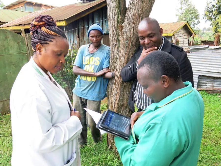
Here we are working with managers from KTDA to test the data-collection app. The assistant in the green coat owns a smart phone, but before today she had never used a tablet of any kind. Within a short amount of time she was tapping and swiping away—and conceding that recording information on a tablet would be much easier than the old paper-intensive method. Here she was asking the farmer (seen here, leaning against the tree) some preliminary questions about his farm before walking through his farm with him to collect more data. Another person happy about digitizing records? The field services coordinator in the white coat, whose job it is to manage all the data collected in the field before performing an analysis. Rainforest Alliance Senior Associate for Eastern and Southern Africa Michael Orang’i looks on. Michael formerly worked for KTDA,so he is a familiar—and beloved—figure to many of the smallholders we visited.
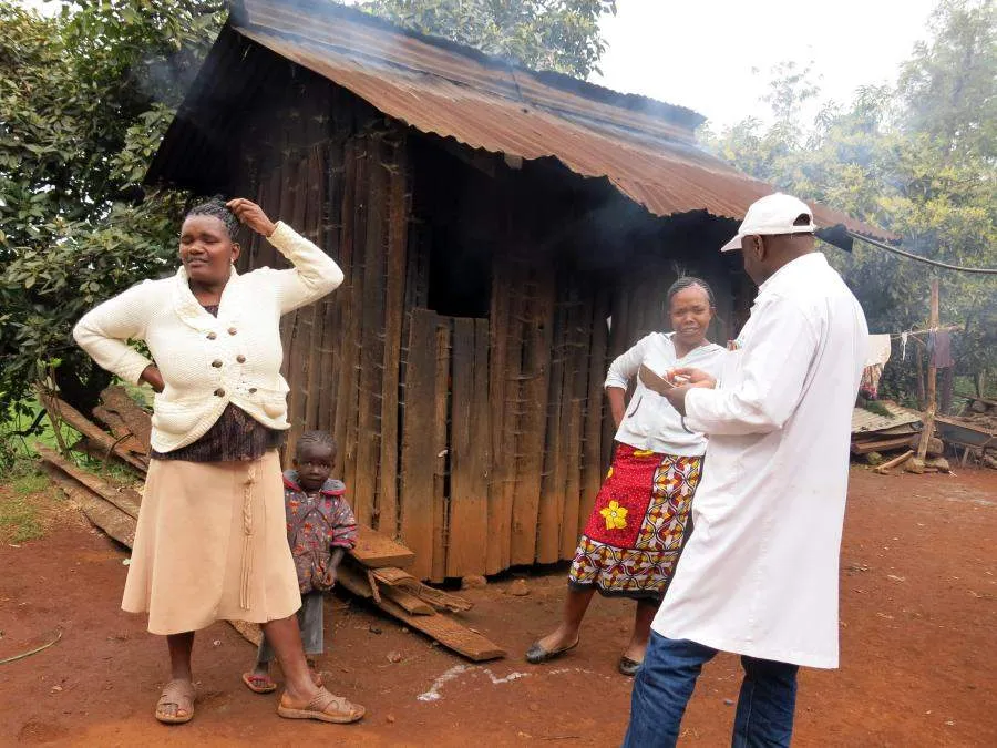
We stopped by the home of Samuel Ngochi Waweu, a smallholder who supplies KTDA’s Mataara tea factory. His wife (right) told us he was due back from the market at any moment, but in the mean time she provided some preliminary data, such as how many people live on the farm and how much land they have. She explained that in addition to cultivating tea, they diversify their income stream with two dairy cows, selling milk at market. I wish I could have chatted with her, but they conversed in Swahili, a beautiful language I would love to learn one day.
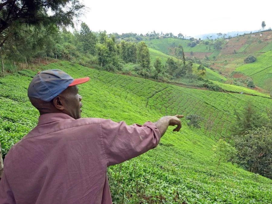
As soon as he returned from market, Samuel Ngochi Waweru showed us around his farm, which he inherited from his father. He is pointing to an area in the distance that he has reforested—which you can see here sits in sharp contrast to the naked patches of land belonging to his non-certified neighbor. As a result of reforesting and other efforts he made to achieve certification, Samuel said, he’s seen birds and other wildlife come back—and best of all, for his family, the productivity of his crops has increased, improving the family’s income.
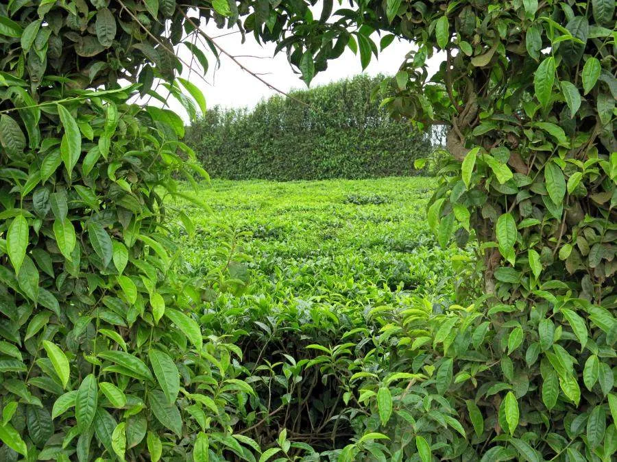
As whimsical as this heart-shaped plant is, it actually has a very pragmatic backstory. Around the borders of their crops, farmers plant tea vertically to create a vegetative barrier that helps keep out undesirable weeds. That the tea plants pictured here happened to take this shape makes absolute sense to me after spending time with the smallholder farmers of this region, who have put so much time and energy—and yes, heart—into improving the health of their land.

